.png)
The Village of Denmark was incorporated on June 15, 1915. Later that same year, the Village created a Parks and Recreation program for its early settlers. In June of 2000 the Village retained the services of Ranger Services, Inc. and developed their first Urban Forestry Management Plan as well as creating a Parks, Recreation and Forestry Committee to focus on both parks and leisure (passive and active) opportunities for its residents. The Comprehensive Outdoor Recreation Plan for the Village was originally adopted on June 6, 1994; this Plan was updated in February 2001 and again on April 5, 2004. The Village's Comprehensive Outdoor Recreation Plan 2010-2015 was adopted on July 5, 2010. The philosophy established in this Plan stated that "outdoor recreation and open spaces lend both form and function to the Village, enhancing the attractiveness and sense of civic pride. The provision of areas, facilities and activities to accommodate public recreation and needs have long been demonstrated to promote the general health, welfare and safety to the community, residents and visitors."
The Village provides various parks, recreational facilities and open space categories which are divided into the following categories:
- Pocket Parks: a very small park typically less than an acre in size that serves a community within a one-fourth (1/4) mile radius. Such a park may be a playground, picnic area and one (1) active sport area at most. Pocket parks are designed for pedestrian access such as sidewalks. Limited on-street parking may be available.
- Neighborhood Parks: a smaller park, typically two (2) to five (5) acres, that serves residential neighborhoods within a one-half (1/2) mile radius with both uses and amenities similar to those found in a community park. There are normally fewer amenities and a parking lot may not be present due to pedestrian accessibility and the potential for on-street parking.
- Community Parks: a larger park, typically greater than five (5) acres that serves the entire community within a two (2) mile radius with both active and passive uses.
- Community Recreational Facilities: a public recreational facility that has one (1) intended specific use. The facility may stand alone or be part of a larger park site.
- Greenways: a linear park or open space conservation area that provides passive recreational opportunities, pedestrian and/or bicycle paths, wildlife corridors and/or the conservation of open spaces or natural areas.
- Public Sidewalk Systems: a paved path for pedestrians alongside a street.
- Recreational Trails: an off-street route through a natural area or the countryside that links paths, streets, parks and other points of interest.
- Natural Open Spaces: an area or portion of unimproved land and/or water that is retained for passive recreation uses areas or for resource protection in an essentially undeveloped state.
- Undeveloped Park Parcels: property that has not been developed into an active or passive park, but may have potential to be acquired and/or developed for park purposes.
- School District Facilities: one (1) or a combination of activities or facilities with the recreational functions of a public or private school. Such facilities may not be readily accessible to the general public.
Within the Village
Pocket Park - in the central business district on East Main Street there is a small one-half (1/2) acre that contains picnic tables, a water fountain with fish and park benches.
Neighborhood Parks
- Daybreak Neighborhood Park: located on Woodrow Street is a relatively recent park of approximately four (4) acres. It features a gravel walking trail, a gazebo, a playground area and an off-street parking lot. The southern area of this park features a windmill with a pond aeration system and park benches. These features were designed to show residents how to deal with storm water run-off concerns.
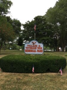
- Community Parks - Veterans Memorial Park located on Wisconsin Avenue comprising a total of thirty (30) acres of which nineteen (19) are owned by the Village and eleven (11) owned by the Veterans. This park contains shelters, both upper and lower concession stands, two (2) lighted baseball diamonds, a tennis court, a wading pool, a skateboard/ice skating rink area, a playground, a lighted basketball court, picnic areas, a nature trail (the Denmark Creek Ravine Trail), a lighted sledding hill, a tractor pull area, Veterans War Memorial. Additionally, an enclosed park shelter with a kitchen, restrooms and a meeting room is available for rentals call 920-677-2217 for reservation information. There is also an open air shelter (the Lion's Club shelter) and the Boy Scouts cabin. The Village and the Denmark War memorial Veterans have cooperatively worked together in an effort to provide recreational opportunities to the Village as well as other area communities. In 2008 the Village drafted a Memorandum of Understanding which outlines the various arrangements that have been worked out between the various parties. To see these past cooperative arrangements please click on the following listing.
Park/Recreational Facilities Fees
Community Recreational Facilities - The Village proposed this 7.03 acre park (Highridge Park) for acquisition/development in June 1994. After acquisition a baseball sports facility was constructed through the efforts of a local fundraiser which collected $31,000.00 in cash and with the help of volunteers and funding from the Village an additional $80,000.00 bathroom/concession/scorer's stand with a fenced, lighted baseball diamond and bleachers was constructed. The ballpark consumes the majority of available acres, however, there is a small amount of acreage remaining to the south of the ball field that was landscaped during the summer of 2003 and trees were planted along Diamond Ridge Circle. A trail from the small landscaped picnic area (the Upper Picnic Area Trail) runs from Highridge/Diamond Ridge to the upper picnic area in Veterans Memorial Park over to the schools Nature Preserve area. Both the Village and the Denmark School District share responsibility for the maintenance of this park. Details of this agreement can be viewed by clicking the following listing:
Cooperative 2010 Agreement for Highridge Park property
Greenways - the Village of Denmark owns several parcels of property located along the Denmark Creek.
Public Sidewalk System - there is presently a total of 29,756 feet of sidewalk (or 5.64 miles) of sidewalk within the Village of Denmark.
Recreational Trails
- Devil's River Trailshead: represents the starting point of a recently opened (2012) sixteen (16) mile State Recreation Trail which runs from the Village to Rockwood (just north of Manitowoc, WI). This trail is located on the bed of a former railroad track and features two (2) spectacular former railroad trestle river crossings (West Twin River and Francis Creek). The crushed limestone trail travels near the Maribel Caves through both rural and woodland areas and is utilized by both hikers and bicyclists during the summer months and by snowmobiles and cross country skiers during the winter months. The trailshead in the Village features a depot-shelter building that can be rented from the Village which has a twenty-five (25) person capacity, a meeting room, restrooms and a kitchen. The area also features a pondless waterfall and long-term parking areas.
- The Denmark Creek Nature Trail: consists of two (2) parts; these being the Upper Picnic Area Trail (1/4 mile loop) and the Denmark Creek Ravine Trail (1/2 mile loop).
- Black Walnut Trail: a graveled nature trail approximately 2,000 feet in length which is located in the western part of the Village. The trail traverses a small prairie into a wooded ravine along a small creek located between Green Bay Road and CTH R.
- Denmark Historic Walking Tour: a self-guided excursion through the historic neighborhoods in and near the downtown area that contains sixty (60) landmarks. This walking tour traverses DePere Road, Main Street, Broadway Street, Wall Street, Wisconsin Avenue and several side streets.
Natural Open Spaces
- Triangle Prairie Garden: at the northwest entrance to the Village, located at the corner of CTH R and Green Bay Road which has an established prairie garden initially funded through an Urban Forestry Grant.
- Denmark School District Nature Preserve Area: 4.1 acres which contains a pond, observation areas, trails and a bridge. There are several ongoing projects such as creating an oak-savanna, a prairie and a wetland area.
Undeveloped Park Parcels
None.
School District Facilities - within the Denmark school system there is a total of 37.2 acres made available which includes: a baseball diamond, bleachers, storage and concession stand, an asphalt track, football field, press box, shot put pad, discus pad, soccer goals, playground equipment, basketball hoops and playfields.
Nearby Parks/Facilities Outside of Village
- Neshoto Park: owned/operated by Brown County, this park is located in the northern portion of the Town of New Denmark on Park Road. This 257 acre park includes a playground, sledding hill, shelter, picnic area, restrooms, parking, six (6) miles of hiking/skiing trails and two (2) miles of horseback riding trails.
- Maribel Caves Park: the Manitowoc County Park System maintains this park which is located south of the Village of Denmark. The park contains walking trails, picnic areas, playgrounds and has both a river and caves to explore.
- Devil's River Campground: located near Maribel Caves Park, this privately-owned campground offers campsites, restrooms, a camper's country store, an old grist mill, a swimming pool and walking trails.